Weather forecasting has evolved dramatically over the past decades, transforming from basic observations into a sophisticated science powered by cutting-edge technology and data integration.
🌍 The Evolution of Modern Weather Prediction
Gone are the days when meteorologists relied solely on barometers and visual sky observations to predict upcoming weather patterns. Today’s weather forecasting represents a remarkable fusion of multiple data sources, each contributing unique insights that create an unprecedented level of accuracy. The integration of radar systems, satellite imagery, and ground-based weather stations has fundamentally changed how we understand and predict atmospheric conditions.
This technological revolution has made weather forecasting more accessible, reliable, and detailed than ever before. From farmers planning their harvest to airlines routing flights, and from emergency services preparing for severe weather to individuals deciding what to wear, accurate weather predictions have become essential to modern life.
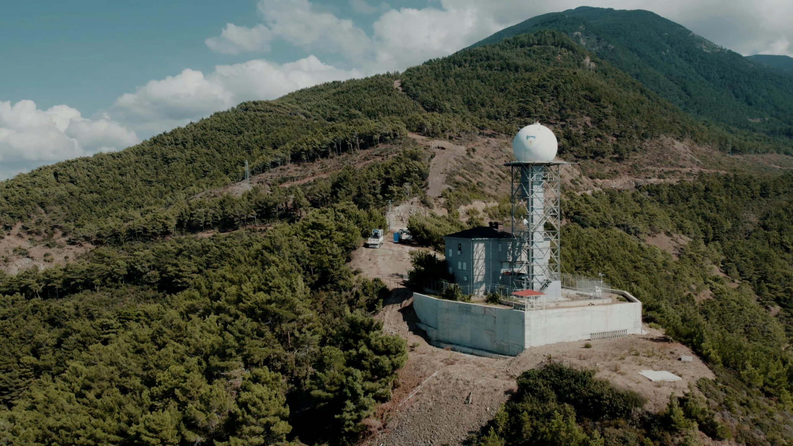
⚡ Understanding Radar Technology in Weather Forecasting
Weather radar stands as one of the most powerful tools in the meteorologist’s arsenal. These sophisticated systems emit electromagnetic waves that bounce off precipitation particles, providing real-time information about rainfall intensity, storm movement, and atmospheric conditions within approximately 250 kilometers of the radar installation.
How Doppler Radar Transforms Weather Detection
Doppler radar technology represents a quantum leap in weather observation capabilities. Unlike conventional radar that simply detects precipitation, Doppler systems measure the velocity of particles moving toward or away from the radar antenna. This capability allows meteorologists to identify rotation within storms, detect wind shear, and predict severe weather events like tornadoes with remarkable precision.
The power of Doppler radar lies in its ability to see inside storms. Meteorologists can observe the internal structure of thunderstorms, identify hook echoes that signal tornado formation, and track the development of severe weather from its earliest stages. This early warning capability has saved countless lives by providing communities with precious minutes to seek shelter before dangerous weather arrives.
Dual-Polarization: The Next Generation of Radar
Modern dual-polarization radar systems send out both horizontal and vertical pulses, dramatically improving the accuracy of precipitation type identification. This technology can distinguish between rain, snow, sleet, and hail with unprecedented precision. It can even detect non-meteorological objects like birds, insects, or debris clouds from tornadoes, providing additional safety information during severe weather events.
🛰️ Satellite Systems: Eyes in the Sky
While radar excels at observing precipitation and storm structure at close range, weather satellites provide the big picture perspective that’s essential for comprehensive forecasting. These orbital platforms continuously monitor vast areas of the Earth’s surface and atmosphere, capturing data that would be impossible to obtain through ground-based systems alone.
Geostationary Satellites: The Constant Watchers
Geostationary satellites orbit at approximately 35,800 kilometers above the equator, maintaining a fixed position relative to the Earth’s surface. This positioning allows them to continuously monitor the same geographic area, providing frequent updates on cloud development, storm evolution, and atmospheric conditions.
The latest generation of geostationary satellites, such as GOES-16 and GOES-17 operated by NOAA, capture full-disk images of Earth every ten minutes and can focus on rapidly developing storms every thirty seconds. This rapid-refresh capability enables meteorologists to track severe weather development with unprecedented temporal resolution, identifying dangerous conditions as they emerge.
Polar-Orbiting Satellites: Global Coverage Specialists
Polar-orbiting satellites take a different approach, circling the Earth at much lower altitudes of approximately 850 kilometers. As the Earth rotates beneath them, these satellites gradually cover the entire planet’s surface, providing global coverage twice daily. Their lower altitude enables higher-resolution imagery and more detailed atmospheric measurements.
These satellites carry sophisticated instruments that measure temperature profiles, moisture content, atmospheric composition, and sea surface temperatures. This data proves invaluable for medium and long-range forecasting, climate monitoring, and understanding large-scale weather patterns like El Niño and La Niña.
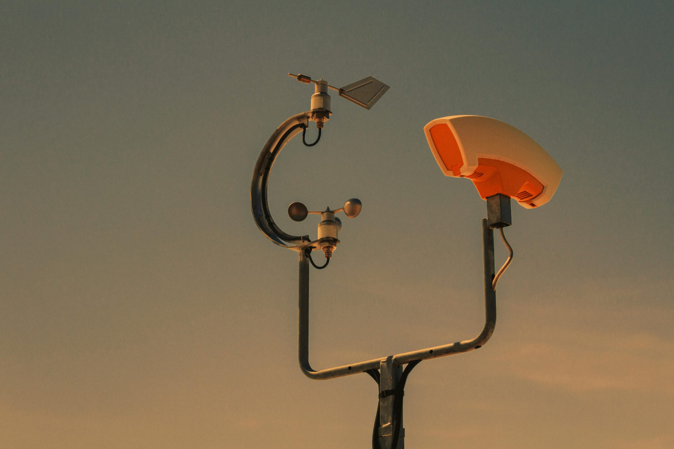
📊 Weather Stations: The Ground Truth Network
While radar and satellites provide extensive coverage from above, ground-based weather stations deliver the precise, local measurements that anchor all weather forecasting efforts. These stations measure temperature, humidity, wind speed and direction, atmospheric pressure, precipitation amounts, and numerous other parameters at specific locations.
The Global Surface Observation Network
Thousands of automated and staffed weather stations operate worldwide, forming an interconnected network that provides continuous atmospheric data. This network includes official meteorological stations, airport weather systems, maritime buoys, and increasingly, citizen weather observer programs that supplement official data with hyper-local measurements.
Modern automated weather stations use electronic sensors to measure atmospheric conditions every few seconds, transmitting data continuously to central databases. This real-time information flow ensures that forecasters always have access to current conditions, essential for initializing computer forecast models and verifying predictions.
Specialized Observation Systems
Beyond standard weather stations, specialized observation systems contribute crucial data for specific forecasting needs. Upper-air weather balloons, launched twice daily from hundreds of locations worldwide, measure temperature, humidity, and wind conditions from the surface to altitudes exceeding 30 kilometers. Aircraft reports provide valuable data about atmospheric conditions at flight levels, while lightning detection networks track electrical storm activity in real-time.
🔬 The Science of Data Integration
The true revolution in weather forecasting emerges not from any single technology, but from the sophisticated integration of multiple data sources. Modern numerical weather prediction models assimilate millions of observations hourly, creating a comprehensive three-dimensional picture of the atmosphere’s current state.
Data Assimilation Techniques
Data assimilation represents one of the most mathematically complex aspects of modern meteorology. Advanced algorithms combine observations from radar, satellites, weather stations, and other sources, weighing each measurement according to its accuracy and relevance. These techniques must account for observation errors, instrument biases, and the fact that different sensors measure different aspects of atmospheric conditions.
The output of data assimilation serves as the initial condition for computer forecast models. The quality of these initial conditions directly impacts forecast accuracy, making effective data integration absolutely critical to reliable weather prediction.
Ensemble Forecasting: Accounting for Uncertainty
Modern forecasting systems run multiple model simulations with slightly different initial conditions, creating ensemble forecasts that provide probabilistic predictions rather than single deterministic outcomes. This approach acknowledges the chaotic nature of the atmosphere and provides forecasters with valuable information about prediction confidence and potential alternative scenarios.
📱 Bringing Advanced Forecasting to Your Pocket
The technological revolution in weather forecasting has extended beyond professional meteorology centers to consumer applications. Modern weather apps leverage the same radar, satellite, and station data that professional forecasters use, delivering sophisticated predictions directly to smartphones and tablets.
These applications provide access to real-time radar imagery, satellite loops, hour-by-hour forecasts, and severe weather alerts. Many incorporate location-based services to deliver hyper-local predictions, while others offer specialized features for specific activities like aviation, marine operations, or outdoor recreation.
🎯 Real-World Impact of Integrated Weather Forecasting
The combination of radar, satellite, and station data has delivered tangible benefits across numerous sectors, fundamentally changing how society prepares for and responds to weather conditions.
Saving Lives Through Severe Weather Warning
Perhaps the most significant impact of modern weather forecasting lies in its life-saving capabilities. Advanced warning of hurricanes, tornadoes, severe thunderstorms, and other dangerous weather phenomena provides communities with crucial time to evacuate, seek shelter, or take protective measures. The dramatic reduction in weather-related fatalities over recent decades testifies to the effectiveness of integrated forecasting systems.
During hurricane events, the combination of satellite tracking, coastal radar coverage, and dense station networks enables forecasters to predict landfall locations, intensity changes, and rainfall amounts with increasing accuracy. This information guides evacuation decisions, emergency resource deployment, and public safety messaging, potentially saving thousands of lives during major events.
Economic Benefits Across Industries
Beyond safety, improved weather forecasting delivers substantial economic benefits. Agriculture relies on accurate predictions for planting, irrigation, and harvest timing decisions. The energy sector uses weather forecasts to predict demand, optimize renewable energy production, and prepare infrastructure for extreme conditions. Transportation industries depend on weather information for routing decisions, operational planning, and safety management.
Studies estimate that weather-sensitive sectors account for nearly one-third of the United States GDP, making accurate forecasting an economic necessity. Even modest improvements in forecast accuracy can generate billions of dollars in economic value through better decision-making and reduced weather-related losses.
🚀 Future Innovations in Weather Data Integration
The revolution in weather forecasting continues to accelerate as new technologies emerge and existing systems improve. Several promising developments suggest even more accurate and detailed predictions in the coming years.
Artificial Intelligence and Machine Learning
Artificial intelligence and machine learning algorithms are beginning to transform weather forecasting. These systems can identify complex patterns in vast datasets, improving nowcasting (very short-range prediction), severe weather detection, and forecast accuracy. Machine learning models can also optimize data assimilation processes and help forecasters interpret ensemble predictions more effectively.
Neural networks trained on historical weather data and radar imagery show particular promise for precipitation nowcasting, potentially predicting rainfall location and intensity minutes to hours in advance with greater accuracy than traditional methods. As these technologies mature, they will likely become integral components of operational forecasting systems.
Next-Generation Observation Networks
Future observation systems promise even more comprehensive atmospheric monitoring. Plans for expanded satellite constellations, including small-satellite networks providing rapid-refresh imagery and specialized measurements, will enhance global coverage and temporal resolution. Ground-based radar networks continue to expand, filling coverage gaps and upgrading to more capable systems.
Perhaps most intriguingly, the Internet of Things revolution enables new sources of weather data. Connected vehicles, smart home sensors, and mobile devices can potentially contribute atmospheric observations, creating an unprecedented density of surface measurements. While significant challenges remain in quality control and data management, crowd-sourced observations may eventually supplement traditional networks.
🌟 The Synergy That Drives Accuracy
The fundamental strength of modern weather forecasting lies in the synergistic relationship between radar, satellite, and station data. Each source compensates for the others’ limitations, creating a comprehensive observational framework that captures atmospheric behavior from multiple perspectives.
Radar provides high-resolution, three-dimensional information about precipitation and storm structure but has limited range and cannot see through the Earth’s curvature. Satellites offer broad coverage and continuous monitoring but may struggle with certain atmospheric features and provide less vertical detail than radar. Weather stations deliver precise point measurements but cannot capture conditions between observation locations.
Together, these systems create a complete picture that exceeds what any single source could provide. This integration, combined with sophisticated computer models and human expertise, enables the remarkable forecast accuracy that modern society depends upon.
💡 Maximizing the Benefits of Modern Forecasting
Understanding how integrated weather forecasting works empowers individuals and organizations to make better use of available predictions. Recognizing that different forecast elements have different accuracy timelines helps set realistic expectations and improve decision-making.
Temperature predictions typically remain accurate for several days, while precipitation forecasts become less certain beyond 3-4 days. Severe weather warnings benefit from very short lead times measured in minutes to hours, while tropical cyclone tracks can be predicted reasonably well several days in advance, though intensity forecasts remain challenging.
The key lies in consulting multiple information sources, understanding forecast uncertainty, and staying updated as new data becomes available and predictions are refined. Modern integrated forecasting provides unprecedented tools for weather preparedness, but maximizing their value requires informed interpretation and appropriate action.
The revolution in weather forecasting continues to unfold, driven by technological innovation, improved data integration, and deeper atmospheric understanding. As radar systems become more sophisticated, satellite networks expand, and observation stations multiply, the accuracy and detail of weather predictions will continue improving. This ongoing transformation ensures that society’s ability to anticipate, prepare for, and respond to weather conditions will only strengthen in the years ahead, protecting lives, supporting economic activity, and enabling better daily decisions for billions of people worldwide.